
| Rainier Home | Contact Infomation | Statistics Explained | Map Information | Scope | Current Conditions |
|---|
STATISTICS:
|
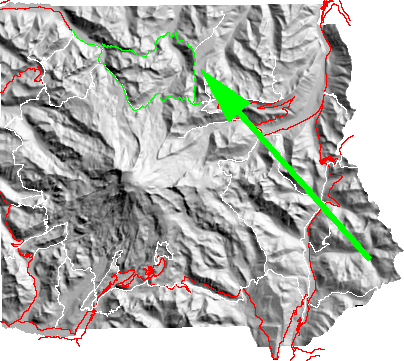
click on map icon to expand map
|
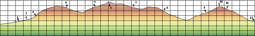
- (1) Turnoff for clockwise loop
- (2) Carbon River Camp/supension bridge area
- (3) Dick Creek Camp
- (4) Mystic camp
- (5) Granite Camp
- (6) Skyscraper Pass
- (7) Berkely Camp
- (8) Fire Creek Camp
- (9) Lake James Patrol cabin
- (10) Windy Gap
- (11) Yellowstone Cliffs
- (12) Return to Carbon River segment of Wonderland Trail
To quote from the Park web site
"A long loop hike in the most pristine wilderness of the Park, through forests and meadows, over rivers, under a cliff of colorful rocks, near the Natural Bridge, past numerous mountain lakes, in ever-changing views of Mount Rainier and its glaciers."
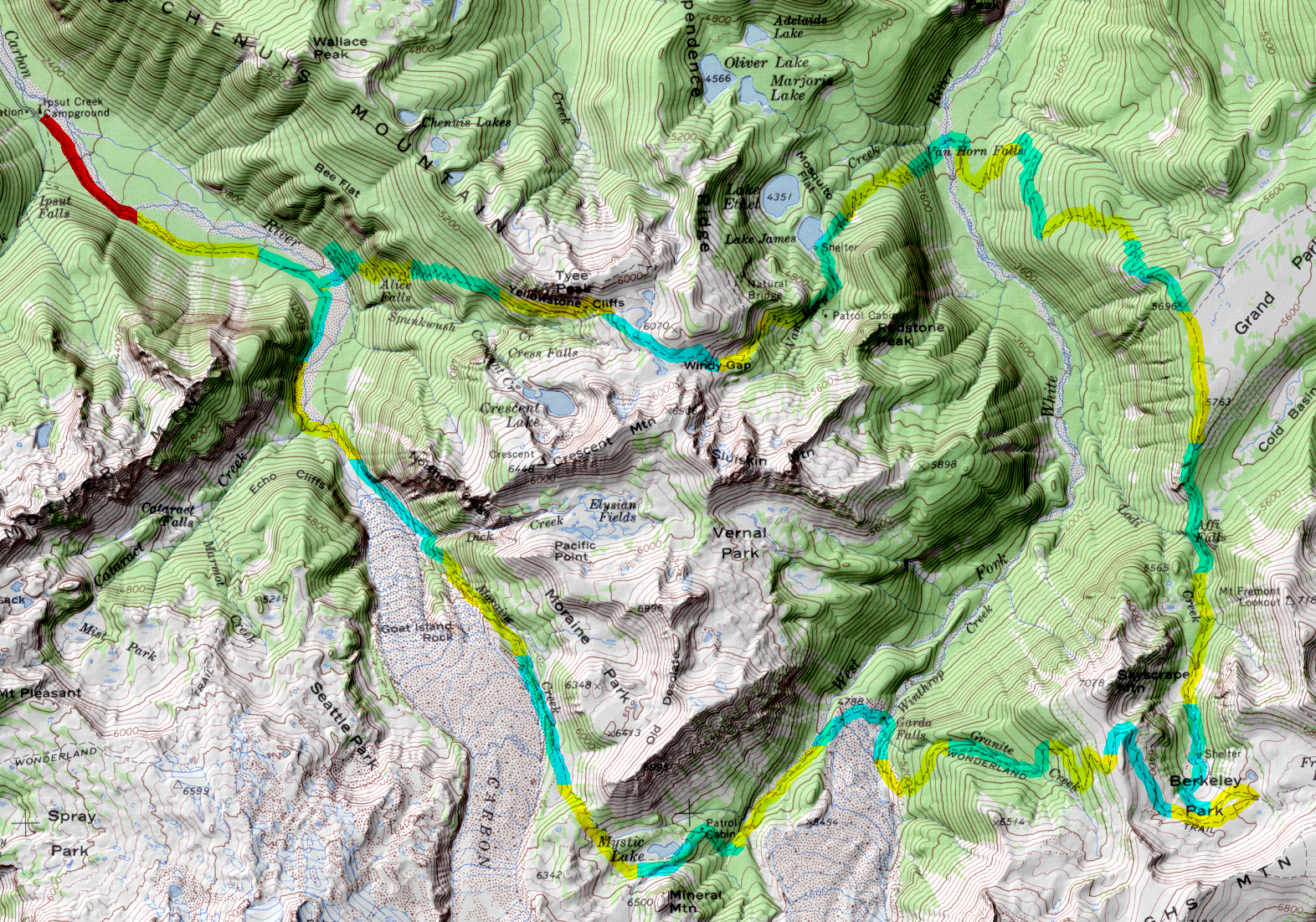
| Map Discription | Size (kb) |
| Small colored elevaton map | 43 |
| Topographic map with shadeing | 2,761 |
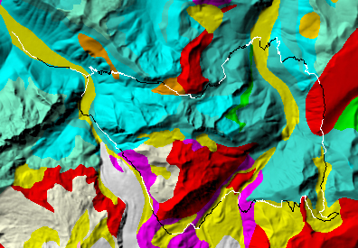
| Shaded Basement Geologic Map | 177 |
|
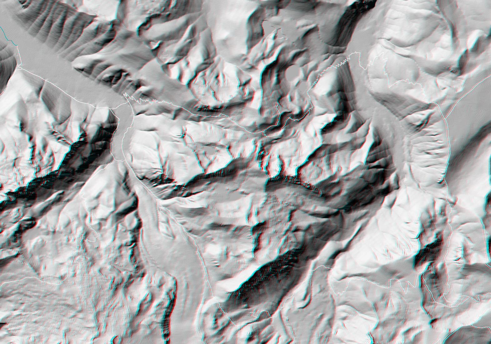
Stereo Map
To see this image you will need special glasses (which I will provide if you contact me before supplies run out) |
1,792 |
return to main Rainier Trail Index
Gregg Petrie ©2000